Eastbourne residents fight against plans for new homes and flats
and live on Freeview channel 276
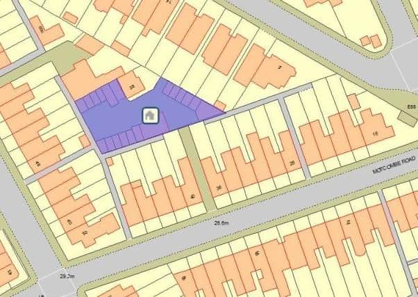
Eastbourne Borough Council has had plans submitted around the use of a parcel of land which is at the back of residential properties, surrounded by Motcombe Road, Charleston Road and Green Street.
Currently the land is used for a number of purposes with a total of 18 garage lock-ups, a two-storey building used for offices/storage and a two-storey building containing two flats.
Advertisement
Hide AdAdvertisement
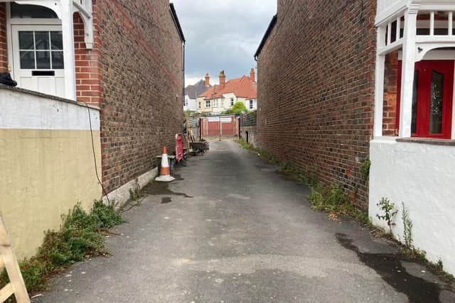
Hide AdThe vehicular access to the site is through a driveway between two properties on Motcombe Road.

If approved, the garages and the office/storage block would be demolished. Three two-storey semi-detached two-bed houses and a block of two flats would be created.
All three houses would have an outdoor patio area, car parking space, and garden shed. One of the houses would be connected to the flats.
The existing access would be ‘utilised and extended across the centre of the site’ according to the plans. Changes that would provide a total of nine new car parking spaces with one space being equipped with an electric charging point. Bike/bin storage and pedestrian access through a gate would be provided too.
Advertisement
Hide AdAdvertisement
Hide AdDespite this, 18 letters of objection have already been submitted by members of the public and East Sussex County Council Highways initially raised many issues with the plans.
Highways argued there was a need for a visibility splay – a drawing than visualises the angle and distance from which drivers emerging from an access point can see and be seen by drivers proceeding along the priority road to ensures that there is good visibility to prevent motor accidents. The Highways statement says the access point is ‘hindered by existing residential walls’.
Highways also raised a problem about the width of the access point of the proposed plans which will create issues for fire engines/service vehicles.
The planners then responded to these problems by submitting a technical note that caused the Highways officer to ‘remove their objection to the use of the access, subject to confirmed that accessibility was suitable for emergency services and refuse teams’.
Advertisement
Hide AdAdvertisement
Hide AdProblems touched on by resident include an increase in traffic causing safety worries and residents argue it’s an overdevelopment of the land.
Neighbour Charlotte O’Callaghan said residents were expecting to be consulted if new amended plans were going to be put forward, but these plans for recommended approval have appeared without any residents knowing.
She said, “We are very concerned about the huge safety issues with the access that Highways identified.
“There have been at least three car crashes on Motcombe road in the last four years, one where a car flipped over, due to poor visibility and yet this is not mentioned nowhere in the report.
Advertisement
Hide AdAdvertisement
Hide Ad“It was objected to by Highways on multiple safety grounds, namely that the access is too narrow and there is not enough visibility at the junction onto Motcombe road, but it is now being recommended for approval.”
Motcombe Road resident Elizabeth Brown said, “The number of houses and flats that are being proposed in this development will mean that a small area is overcrowded. This will cause more parking issues in the surrounding area, increased traffic volumes, pollution and road safety issues.”
To this, planners say the proposed development ‘represents an appropriate and sustainable use of an underused parcel of land that is embedded in a residential setting within the settlement boundary’.
Documents also say it would ‘integrate well with its surroundings and provide a secure and healthy living environment for future occupants as well as neighbouring residents’ and the site parking and access arrangements ‘are considered to be acceptable in terms of highway safety impact and the needs of future occupants’.
The planning committee meeting is taking place on Tuesday September 21 to decide the future of the land.