Hastings could have looked very different


He writes. Last week the contemporary aerial views of Hastings and St.Leonards were highlighted.
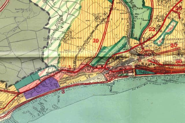
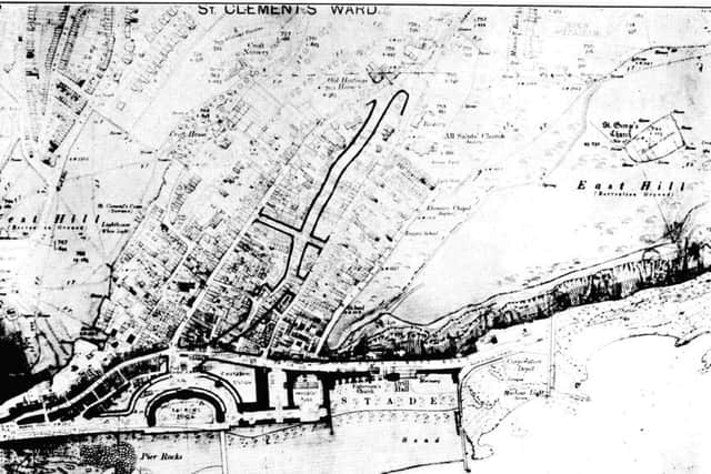
Under the spotlight this week are extracts from the 6-inch-to-the-mile map (30” x 40” -approx 1000mm x 750mm) and plans, sketches and proposals contained in the report.
Advertisement
Hide AdAdvertisement
Hide AdThere were grandiose plans for a new civic centre straddling Bohemia Road, incorporating a Museum and a Museum and Art Gallery with no mention of the fact that the current site of the Museum, John’s Place had been purchased in 1927 and opened 18 months later.
Southern Railway had plans to redesign Hastings Station and its approach but the Development Plan had different designs, far more ambitious and incorporating a lot more of Hastings’ central area.
Plans to drive a road through the Old Town were already in hand to be followed with an open air pool with amusement park and ‘a char-a-banc station’ on a redesigned Stade.
A further bathing pool was proposed for West Marina and this was to open in 1933, close in 1986 and be demolished in 1993. Redevelopment of the seafront had already been agreed and continued from St.Leonards Pier eastward almost to the Fishmarket. Had the Second World war not intervened then the promenade improvements may well have continued westward to the Bathing Pool..
Advertisement
Hide AdAdvertisement
Hide AdToday’s A21 and access to it and London are not mentioned, but access from the west appeared to be raising issues. The Bexhill Road was causing problems even then, and the scheme offered solutions. from widening the existing road (1), a new approach road (2) utilising the reserved tramtrack behind the Bull Inn for traffic from London via Ninfield and Eastbourne. (when the trams were replaced with trolleybuses in 1929 the gradient to the Bull Inn no longer presented a problem and the track became redundant), Scheme (3), a radical idea to on the western approach with a road built on the foreshore using embankments and a bridge south of the railway.
There had been a fairly well known plan to take the coastal road eastward through Rock-a-Nore on a bridge below the cliffs to meet up with the Pett Level Road towards Rye and this was a similar but less well known suggestion for the opposite end of the borough. Also shown on this extract of the map is the redesign of the area round West Marina and West St.Leonards Stations including the amalgamation of the two stations and interestingly also shows, on the extreme left of the extract, Glyne Gap Halt that closed around 1909 because the railway could not compete with the trams; it was not suggested that it should be reopened and today Railtrack tells us that it would be too difficult to have a station at Ravenside.
A second major idea was the proposed Approach Road from Ashford and Canterbury.
“This proposal is inspired partly by the desirability of having a more direct approach than the existing roundabout route via Baldslow, and this is of special importance as an attraction to visitors from the newly developing Kent coalfield; partly as a park-way linking up Alexandra Park with the White Rock Gardens and the centre of the Sea Front, and partly as an improvement in the local means of access about the town. The proposed road starts at the suggested site for the Civic Centre, crosses Priory Avenue at its junction with Linton Road, turns westward down the slopes now occupied by allotment grounds to cross Lower Park Road, Alexandra Park and St. Helen’s Road by means of a viaduct, proceeding northwards up the valley by Hole Farm to link up with Hillside Road and thence by Beaney’s Lane and Stonestile Lane to Westfield. Access to Lower Park Road and St. Helen’s Road would, of course, be provided by carefully graded spurs” – Route No 9 on map b. Would visiting hordes from Kent have materialised if the scheme had been followed?
Advertisement
Hide AdAdvertisement
Hide AdOther new routes proposed were the Crowhurst-Hollington-Ore connection with a new road connecting with proposed road No19 at Hollington; a new road as far as St. Helen’s Road; St. Helen’s Road to Old Roar Gill; a new road from this point to join the existing road north of Pilot Field; a new road to join the existing road south of The Gables; widening of the existing road to the Old London Road and part of Ivyhouse Lane and a new road from this point, to join the Winchelsea Road south of Bachelor’s Bump. Route 22 would be new road from West St. Leonards Station to join the Battle Road at Paynton Road incorporating a new road following the western boundary of Alexandra Park along the existing footpath to connect with Lower Park Road.
All illustrations throughout this series are from Ion Castro’s own collection and there’s more local history on his website, www.historichastings.co.uk
Captions
Map a
The bottom corner of the large map
Map b
Centre of the large map
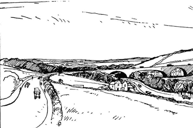
The Proposed Viaduct over Alexandra Park
This is part of a proposal designed to link up the Sea Front and White Rock Gardens with Alexandra Park by a Park Way which, it is suggested should be extended to form a direct approach from Ashford, Canterbury and the East Kent Coalfield.
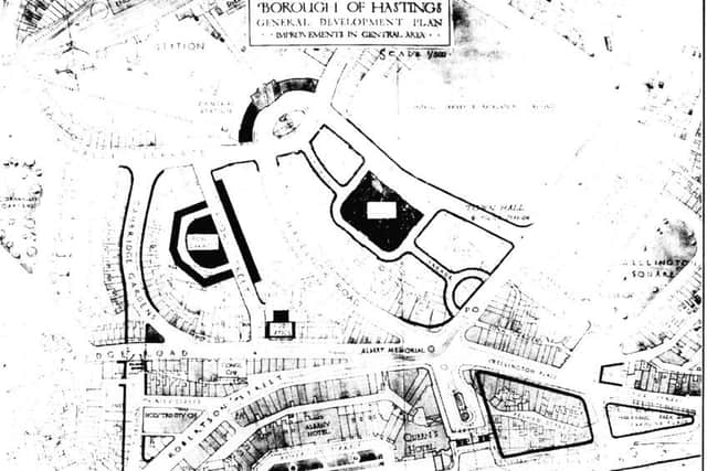
Plan showing Proposed Improvements in the Central Area
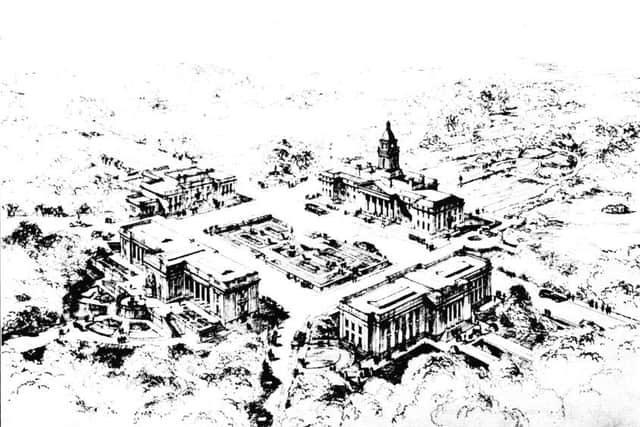
The Proposed Civic Centre
The site, on Bohemia Road adjoining While Rock Gardens, is in a central and commanding position. It is suggested that the Town Hall should front Bohemia Road, with a Museum and Art Gallery facing it, and with a Technical and Art School on the north, and a Museum on the south side of the Square.
Plan of the Proposals in Connection with The Old Town
And
Sketch of the Proposals in Connection with The Old Town
Advertisement
Hide AdAdvertisement
Hide AdAt the end of the Promenade Extension is the Open Air Swimming Pool, with a Char-a-banc Station and Small Amusement Park adjoining. To the east of this group is the re-arranged Stade, with a new Fishmarket in the centre,