
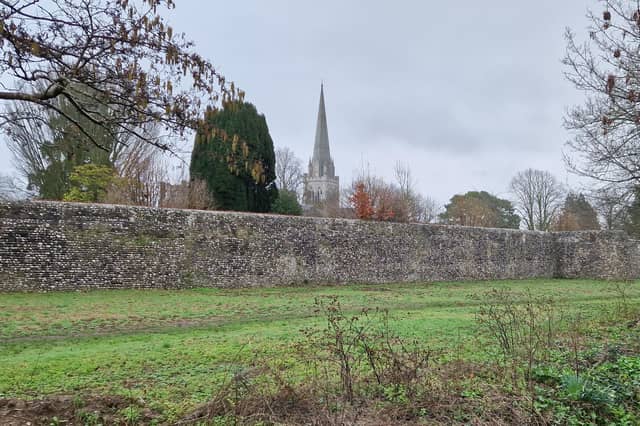


The historic city was founded by the Romans in the 1st century AD and they surrounded it with walls and gateways, some of which can still be seen to this day.
Thanks to the Chichester Walls Trust, there is a clearly marked trail around the city, with information boards en route explaining some of the history. It is the most intact circuit of Roman town defences in southern England.
The walls circuit can be followed on foot for nearly 1.5 miles, with the aid of a leaflet and guide available from the Tourist Information Centre or online at www.chichesterwalls.org/chichester-city-walls
I thoroughly enjoyed my walk round Chichester's walls. It was a wet day in February 2026, proving you can experience and enjoy the history at any time of year, no matter what the weather.
The trust says: "There is so much history hidden away or just below our feet yet to be explored in this city, and more may be discovered of the walls. Even with its gaps, the survival today of a nearly complete walls circuit built 1800 years ago is remarkable, largely explained by its usefulness over the centuries and the city’s slow growth, but also by the commitment of national heritage bodies, local authorities, and concerned local organisations like the Chichester Society and the Chichester Walls Trust, to preserve, enhance, and publicise this important asset of the city."
I started at the site of the South Gate, demolished in 1773 but marked at Chichester’s oldest surviving pub, The Fountain, in South Street. The South Gate sign explains the Romans built a wall with four gateways, with the south gate road leading to Dell Quay.
Walking past the pub and through the car park, you come to the meadowland where cattle grazed - now the Prebendal School's playing fields. As you amble alongside the River Lavant, you see a good stretch of the Roman stone walls, standing 5m high. The bastions were added in the early 4th century and the walls were repaired in the 19th century with flint.
As you walk around the outside of the walls, you can begin looking forward to climbing on to the original Roman ramparts. Find the door into Bishop's Palace Gardens and follow the path around to the right, enjoying all the beautiful plants as you go. You do a full circuit of the gardens, with its view of Chichester Cathedral, before exiting by the same door.
Find the West Gate sign on the wall by The Old Cottage Indian Restaurant. It tells you that the west gate road led to Winchester and Fishbourne Roman Palace, a route that later became the main highway to Portsmouth. The restaurant site was once a gatekeeper's booth for collecting tolls and closing the gates at night. Over the road, the narrow lane North Walls has some 18th century cottages that were built into the wall.
This is one of the best stretches, as you climb on to the ramparts again. It is wider here because it was extended in the 18th century to create a promenade. Prior to that, the walls were kept clear due to their military significance as city defensives.
There is an information board at Chapel Street, showing you how the view to Chichester Cathedral used to look, so you can compare it to today. Here, too, is the first opening that was allowed, apart from the gates, dating from 1830. This gave access to the orchards initially and later allowed for development of Victorian housing outside the walls.
The North Gate sign is on a post by Leaders. It tells you the north gate road ran 40 miles north-west to Silchester in Hampshire. Cross over and head down Priory Lane for access to Priory Park, using a door and path that were funded by the Walls Trust and opened in 1990.
One of the first things you will see is the bowling green, dating back to at least 1658, and behind it the remains of the mound of the Norman castle that William the Conqueror established after 1066. Walking around the ramparts, you also see the Guildhall, the former chapel of the Franciscan Order, and views of the Cathedral.
On the corner of the park, you see how the ramparts continue but you need to walk round the park a little further and out the gate to access them. This does allow you to pause to view the City Gunpowder Store sign before climbing up the steps.
At the end of this section of the ramparts, The East Gate sign can be found on the wall opposite, in Eastgate Square. This tells you that the east gate served as Chichester's first jail in the final years before it was demolished in 1783.
We lose sight of the walls at this point. Either go via St John's Street to reach the Chichester District council car park, or come with me via Market Road and Market Avenue. Although this is a slightly longer route, I liked the fact it gave a view of the walls from the outside as you approach Market Avenue Car Park.
A small archway takes you back inside the city and The Roman Town sign tells you the wall was built for protection and to control trade in the market town, known as Noviomagus Reginorum in Roman times.
There is a small section of the ramparts to walk along here and an intriguing brick building, which was built on top of the Roman bastion to serve as a shed for Cawley Priory. The tunnel I used once gave access to the priory garden, now the car park.
Walk along Theatre Lane to return to The Fountain to complete the circuit. Wondering why it is called Theatre Lane? Well, the Zizzi restaurant occupies the former 18th century theatre.
I thorough enjoyed the Chichester City Walls trail and encourage everyone to give it a go.
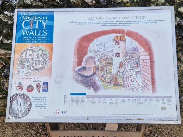
9. Chichester City Walls
Information boards en route explain some of the history Photo: Elaine Hammond
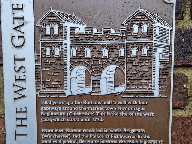
10. Chichester City Walls
Find the West Gate sign on the wall by The Old Cottage Indian Restaurant Photo: Elaine Hammond
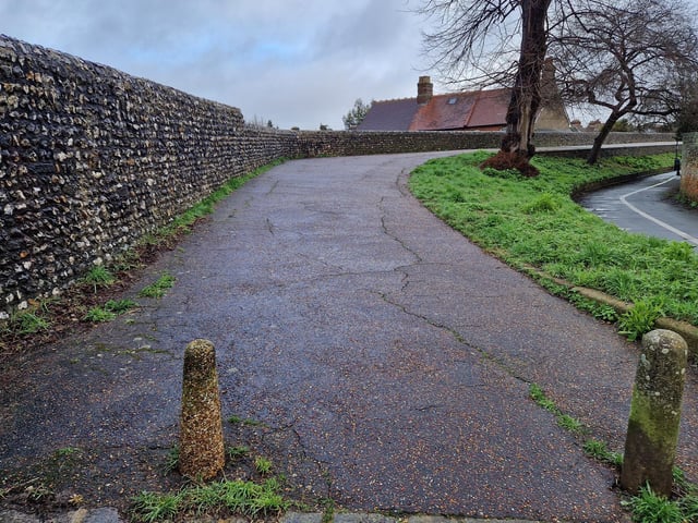
11. Chichester City Walls
This is one of the best stretches, as you climb on to the ramparts again via North Walls Photo: Elaine Hammond
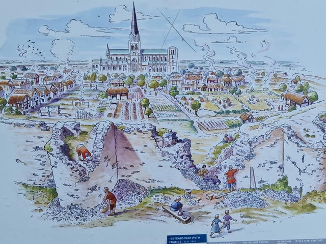
12. Chichester City Walls
The information board at Chapel Street shows how the view to Chichester Cathedral used to look Photo: Elaine Hammond