
Lightning strikes spark house fires in Eastbourne and Bexhill - In pictures

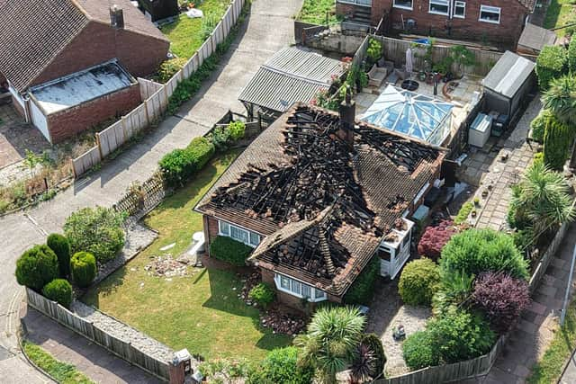
Lightning strikes are believed to have caused serious fires at two homes, in East Sussex overnight, prompting a major response from firefighters.
East Sussex Fire and Rescue Service was first called at 12am on Saturday, June 27, to reports of a roof fire at a property in Selmeston Road, Eastbourne.
Just 15 minutes later, crews were dispatched to Long Avenue, Bexhill, following reports that a house had caught fire after being struck by lightning.
Joint Fire Control received multiple emergency calls as thunderstorms moved across the county, with four fire engines initially sent to each incident.

Firefighters confirmed there were no reports of injuries at either property.
An update issued at 1.30am said crews in Eastbourne had made good progress, with firefighters checking for hot spots before a planned re-inspection at 6am.
By 2.20am, the response in Bexhill had been scaled back to three fire engines after crews brought the blaze under control.
The fire service said ongoing lightning strikes and overhead power cables made operations more challenging.
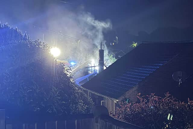
During the night, Joint Fire Control received 16 emergency calls relating to the Bexhill fire and five concerning the Eastbourne incident.
In a final update at 7am, the fire service said firefighters remained at the Bexhill property, using an aerial ladder platform as a water tower once the lightning had eased. Crews continued damping down hot spots, with a further inspection planned for around midday.
In Eastbourne, a thermal imaging camera was used during a re-inspection, with no remaining hot spots detected. That incident has now been closed.
Both properties suffered serious damage, although no casualties were reported.
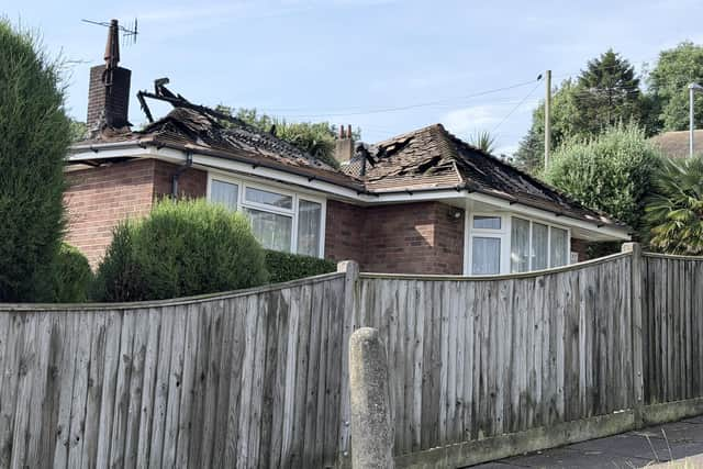
The fire service has not yet confirmed the exact cause of either blaze, but both are reported to have been started by lightning strikes during the overnight storms.
Thunderstorms and flashes of lightning swept across parts of Sussex overnight, bringing a dramatic change after days of record-breaking heat across the UK.
Heavy showers moved through the county during the early hours of Saturday (June 27), as the prolonged hot spell began to ease, although forecasters say temperatures will remain very high and there is still a chance of further thundery showers later today.
The unsettled weather follows an exceptional week in which the UK provisionally recorded a new June temperature record for the third consecutive day. The Met Office said a temperature of 37.3C was reached at Santon Downham in Suffolk on Friday, surpassing the previous June record of 35.6C, subject to official verification.
Despite the overnight storms, an amber warning for extreme heat remains in force until 9pm, on Saturday. This affects most of Sussex and the whole of Surrey. Chichester is outside the amber warning area.
The Met Office warns that vulnerable people are likely to experience adverse health effects, while the wider population could be affected by dehydration, heat exhaustion and sunburn. It also says the hot weather could lead to disruption on roads, railways and at airports, increased pressure on power networks, and a greater risk of water-related incidents as people head to beaches, rivers and lakes.
The BBC’s katest forecast for Sussex says: "Temperatures [are] down compared to yesterday, but still very hot. Showers clearing this morning, leaving it largely dry and sunny. Later on, a few further thundery showers could push in from the south."
Saturday night is expected to become dry with clear spells after any remaining showers clear away. Sunday will be a little cooler, with sunny intervals, variable cloud and only the chance of an isolated light shower before turning dry later in the day.
Southeastern England will be among the last parts of the UK to see temperatures return closer to seasonal averages, with generally warm but less extreme conditions expected, from Sunday, into next week.