



The UK has enjoyed some sunny and warm conditions this week, but the settled weather may not last, according to the latest Met Office forecast.
Wednesday and Thursday has seen glorious sunshine – with photos showing people taking the opportunity to relax on Brighton beach.
Some eye-catching kites have also been pictured on Goring beach in West Sussex.
But a shift to unsettled conditions is on the horizon.
A Met Office spokesperson said: “Fine and dry weather will see temperatures peak on Thursday, before a transition to more unsettled weather over the weekend.
“Much of the UK has had settled weather in recent days, with warmer air also moving in from the south and southwest.”
Met Office Chief Meteorologist Jason Kelly explained: “High pressure to the east of the UK is helping to draw warmer air north across the country, resulting in temperatures well above average for the time of year.
“Thursday is likely to see temperatures peak as part of this meteorological set-up, likely reaching around 20°C in some spots in the south. It’ll also be a widely sunny day for the UK, with just patchy fair-weather cloud in central areas of England at times.”
If temperatures reach 20°C on Thursday, that would make it the warmest day of the year so far, the Met Office said. This was, though, described as a ‘very common occurrence as we move through meteorological spring’.
The outlook for Friday to Sunday is less positive.
The forecast reads: “Rain and showers this weekend, these perhaps heavy with thunder, but some sunny intervals also possible. Probably drier Monday. Winds easing. Low cloud with fog at times, especially on coasts.”
The Met Office has also issued a UK long range weather forecast – for Tuesday, March 25 until Thursday, April 3.
"The final week or so of March to the start of April looks to be characterised by a slowly evolving, generally changeable weather pattern,” a spokesperson for the national weather and climate service said.
“Initially a more widely dry interlude seems likely but with time these drier conditions become more favoured across the south, where overnight fog is also a possibility.
"Further north and northwest, there is a greater chance of rain or showers at times, these accompanied by windier spells with a chance of gales for parts of the far northwest especially. There is a small chance that these wetter, windier conditions may become more widespread for a time.
"Temperatures will probably pan out close to average overall, though chilly nights remain possible where clear skies coincide with light winds.”
The Met Office said the first week of April will ‘likely continue in this vein’, though it ‘could throw up the odd surprise’.
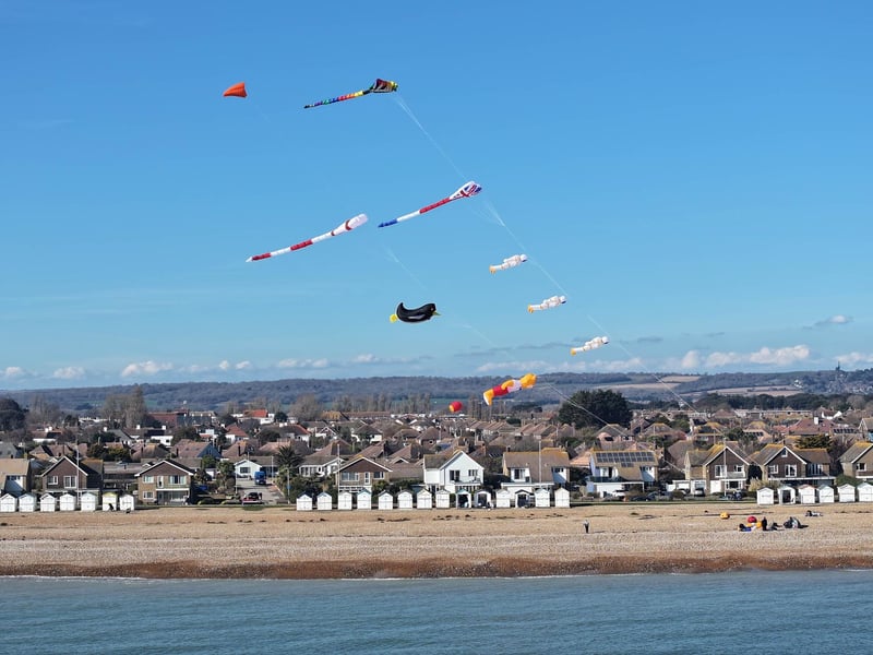
9. Sussex sunshine
Some eye-catching kites have been pictured on Goring beach in West Sussex. Photo: Eddie Mitchell