
Storm Chandra: Drone footage shows extent of flooding around West Sussex village amid multiple alerts and warnings across county

Newly released drone footage shows the extent of the flooding around Pulborough.
This comes amid multiple flood alerts and warnings across the county, following heavy rainfall brought by Storm Chandra.
An Environment Agency warning means that flooding is expected and residents should act now. There were six of these warnings in place, across Sussex, as of 10.45am, on Wednesday (January 28).
Flood warning for the River Arun at Pulborough, including Greatham Bridge, read: “High river levels are expected to cause flooding on Wednesday.
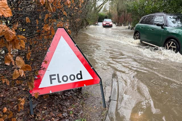

“Flooding is expected from 09:00, as a lot of rain (30mm) fell on Tuesday.
“Flooding will affect properties on Lower Street and Swan Corner, Pulborough, near to Swan Bridge and Bridge Cottages, Greatham. Water will be extensive through fields and will affect gardens and the A29 at Pulborough.
"Only isolated showers are forecast until Friday. River levels should begin to fall in Pulborough by 7pm on Wednesday.
"However, river levels will fall slowly, flood impacts may affect properties until Friday, and gardens until the weekend. Further rain Friday and Saturday may slow the river's fall.
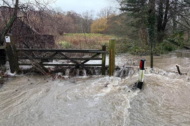
“We are closely monitoring the situation .
“Activate any flood protection products you may have. Avoid roads that flood (A29). Install flood protection in Pulborough.”
High tides on Wednesday morning and evening were also expected to bring water close to properties near Houghton Bridge, Amberley and Arundel, including Mill Road car park.
Drone footage showed a serious-looking situation in Pulborough on Tuesday. The area was previously only covered by a flood alert. This meant that flooding is ‘possible’ and residents should ‘be prepared’.
Flood warnings remained in place for Fittleworth, on the Western River Rother, as well as on the West Sussex River Rother, from Lodsbridge to Shopham Bridge, including Lodsbridge at Selham, Coultershaw Bridge, and Shopham Bridge.
Communities were also at risk of groundwater flooding to the north of Chichester, including West Dean, Singleton, Charlton, East Dean and Chilgrove.
Yellow weather warning lifted
The Met Office issued a yellow rain warning from midnight until 12pm on Tuesday (January 27). This impacted West Sussex, East Sussex and Surrey.
Further amber and yellow warnings for rain, wind and snow came into force elsewhere in the UK on Monday and Tuesday.
"Storm Chandra bringing outbreaks of heavy rain with some transport disruption and flooding in places,” the Met Office advised.
"Heavy rain likely to lead to some transport disruption and possible flooding in places.
“Spray and flooding on roads probably making journey times longer.
"Bus and train services probably affected with journey times taking longer.
"Flooding of a few homes and businesses is possible.
"Some interruption to power supplies and other services possible.”
The Met Office warned that spells of heavy rain are expected during Monday night through to Tuesday morning.
A yellow warning for ice has been issued for a large part of the UK – but the only Sussex area impacted is Crowborough. From midnight until 10am on Wednesday, patchy ice is ‘likely to form on untreated surfaces’ and ‘may lead to some disruption’, according to the Met Office.