
Travel disruption warning amid heavy rainfall in Sussex and Surrey: Flood alert issued

There is a risk of flooding across Sussex and Surrey, with a yellow warning for rain in place.
The Met Office’s yellow warning – in place until 2pm on Wednesday (September 3) – stated that heavy rain ‘may cause travel disruption and flooding in places’. A thunderstorm warning is also in place for other parts of the UK – from London northwards.
The Environment Agency has issued seven flood alerts across the UK – including one in the Sussex area. This means that flooding is possible and residents should ‘be prepared’.
The flood alert for Scrase Bridge and West Common Streams, in Mid Sussex, was issued at 1.50pm. This reads: “The Scrase Bridge and West Common Streams are high and rising – 15mm of rain has been recorded at Haywards Heath in the last two hours.

"From 13:30 minor flooding could affect a small number of commercial properties on Bridge Road and residential properties on West Common Road.
"Minor flooding could affect properties near the Witch Inn, along Hickmans Lane and Blackthorns. Odd numbered properties from 29 to 47 on Meadow Drive could be affected by flooding.
"A further five to ten mm of rain is possible over the next six hours. The river should begin to fall by 14:30 and return to normal from 16:00.
"Flood impacts should ease as river levels fall. There is 10-20mm of rainfall possible tomorrow, Thursday 04/09/2025.
"If you see a blockage affecting the flow in the river on Bridge Road or Hickmans Lane, please call our incident hotline on 0800 80 70 60.
"We are clearing debris from grilles through Lindfield, including the Builders Centre and Witch Inn, to help keep the river flowing freely and reduce flood risk.”
Local flooding is probable from surface water across parts of England.
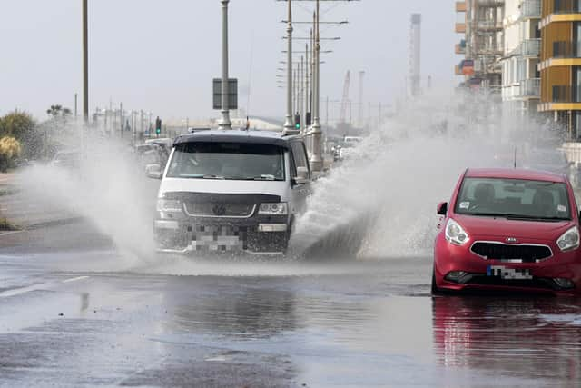
Photos take n on Wednesday afternoon show large amounts of surface water on Kingsway, Hove – resulting in difficult driving conditions.
“Land, roads and some properties could flood and there could be travel disruption,” the Environment Agency warned.
“Local flooding is possible but not expected from surface water across parts of England on Thursday.
“Properties may flood and there may be travel disruption.”
Six flood alerts are in place across the UK but, as of 12pm on Wednesday, there are none in the South East.
However, a yellow warning from the Met Office means ‘flooding of a few homes and businesses is possible’.
The government agency added: “Some interruption to power supplies and other services is possible.
"Spray and flooding on roads probably making journey times longer.
"Bus and train services probably affected with journey times taking longer."
The Met Office said heavy rain and strong winds will move northeast through the first part of Wednesday, ‘followed by heavy showers and some thunderstorms’. These are expected to become ‘more isolated through the afternoon’.
The forecast read: “Rainfall totals widely 20-30 mm, but some places could see 40-60 mm within a period of six to nine hours.
"Coastal gales are likely for a time, especially along English Channel coasts.”
People in the warning area are advised to ‘give yourself the best chance of avoiding delays’ by checking road conditions if driving, or bus and train timetables and amending your travel plans if necessary.
The Met Office added: “Check if your property could be at risk of flooding. If so, consider preparing a flood plan and an emergency flood kit.
"Be prepared for weather warnings to change quickly: when a weather warning is issued, the Met Office recommends staying up to date with the weather forecast in your area.”