For those who can manage hills, we are ending with a walk up to the remains of Bramber Castle. Along the way, we will enjoy beautiful views of the rolling hills of the South Downs National Park and listen to the birds. There is a free car park in The Street in Bramber, or you can reach here by bus. There is the Brighton & Hove no.2 and no.60, as well as the Compass Bus no.100 and no.106, so you can get here easily from Shoreham, Steyning, Brighton and Hove, Rottingdean, Burgess Hill and Henfield.
Walk east towards St Mary's House and on past its garden before taking the footpath on the right, following the driveway behind the house to start with. You will see a sign for Downland Park ahead. Turn left just beyond the sign to make your way towards the River Adur. You will reach a T-junction beside the river. To the left, you will see Bramber Bridge, the site of a minor skirmish during the First English Civil War. We, however, are turning right to walk along beside the river. Here you can enjoy some lovely views over to Annington Hill and Coombes. Continue along the footpath, passing under the A283. The designated A Walk For All route continues, clearly marked to show no cycling or horse riding. You will see Shoreham Cement Works ahead in the distance.At the end of the designated A Walk For All route, we are turning right to follow the South Downs Way for a short distance. This is also the Downs Link and that is the path we are taking for a while.
Please be aware this is a shared used route and popular with cyclists but it is still largely flat and wide enough for pushchairs. Before long, we come to a junction where we leave the South Downs Way and turn right to continue along the Downs Link. This is a fairly straight, wide and level path. It is well signposted, so it is easy to follow the Downs Link route. We are working our way back towards the A283 bridge over the river. Just before you come to it, there is a slope and here is really the only challenge on an otherwise level path. You could rejoin the designated A Walk For All route here, if you wish.
We are going to continue along the Downs Link, however. Go through the gate and take the path straight ahead. You will see the mobile home park ahead and will soon curve round past it towards a bridge. Cross the waterway and turn right to follow the Downs Link. Soon, you will see a view of Bramber Castle in the distance. The signposts offer various options but we are staying on the same path. This will bring you out alongside the A283 for a short distance. As you head back through the trees, a sign warns you of the road ahead and here we start to go uphill.
Cross The Street and head up the road in between the turrets. Be aware this is the entrance to the English Heritage car park. Continue through the car park towards the church. The Parish Church of St Nicholas Bramber Castle was built by William de Broase in 1073 as part of his castle residences and defences. The remains of the Norman castle stand proud. The one surviving wall of the tower gives a glimpse of how it once was and a climb to the top of the motte affords stunning views. It is worth taking time to explore this magical place and seeing what is left of the fortifications. When you have finished, go back down past the church and head left past the lychgate. There are steps back down to The Street. Turn left to go past The Old Tollgate and you will soon be back at the starting point.
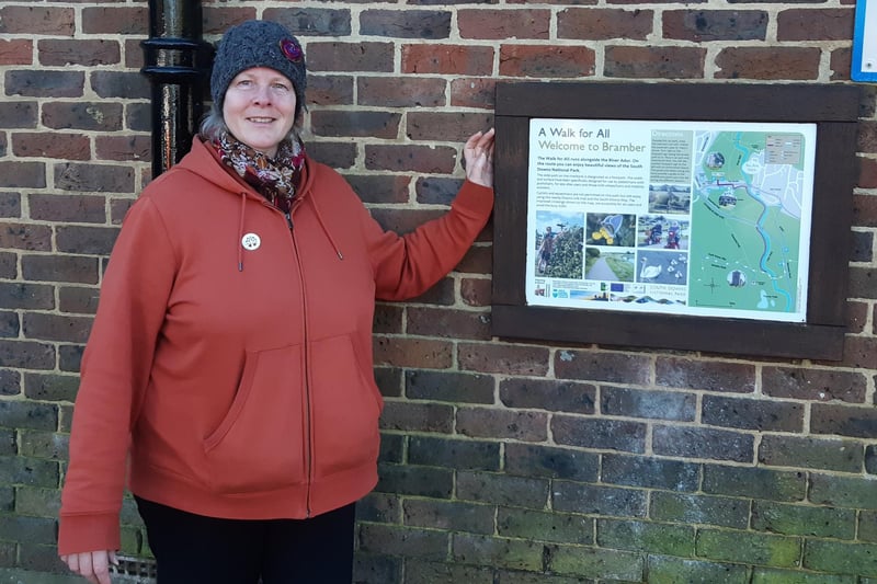
1. A Walk For All Bramber and beyond
This walk along the River Adur at Bramber is part of reporter Elaine Hammond's new series of West Sussex walks, using photos and video to guide you Photo: Elaine Hammond
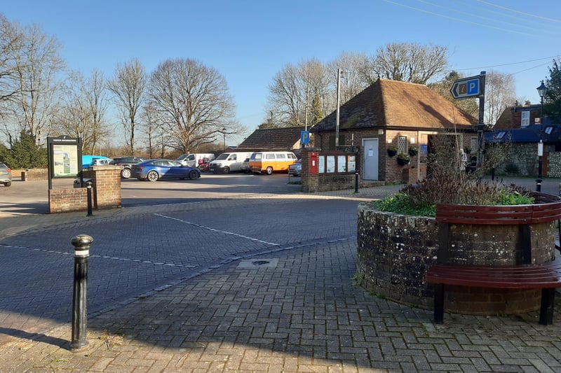
2. A Walk For All Bramber and beyond
There is a free car park in The Street in Bramber, or you can reach here by bus Photo: Elaine Hammond
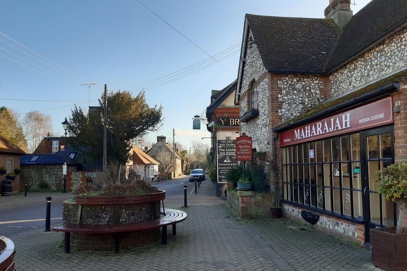
3. A Walk For All Bramber and beyond
Walk east past Maharajah and The Castle Inn Hotel Photo: Elaine Hammond
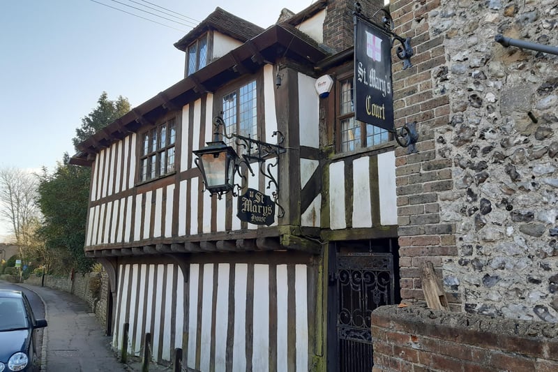
4. A Walk For All Bramber and beyond
Make your way towards St Mary's House and continue on past its garden Photo: Elaine Hammond