
Company prepares to submit outline planning application for up to 215 homes in Uckfield

A company is preparing to submit an outline planning application for up to 215 new homes in Uckfield, according to a report submitted to Wealden District Council (WDC).
Martin Grant Land hopes to build the properties on land to the north of Bird in Eye Hill.
Planning and development consultancy Turley submitted an Environmental Impact Assessment Screening Report to WDC, ahead of the application, on behalf of Martin Grant Land, to obtain an EIA Screening Opinion from the council.
The report said: “The proposed development comprises the following: ‘Outline application with all matters reserved (except access) for a development comprising demolition of existing buildings, and provision of up to 215 dwellings (use Class C3), including affordable dwellings, with associated suitable alternative natural green space, public open space, landscaping and infrastructure works’.”
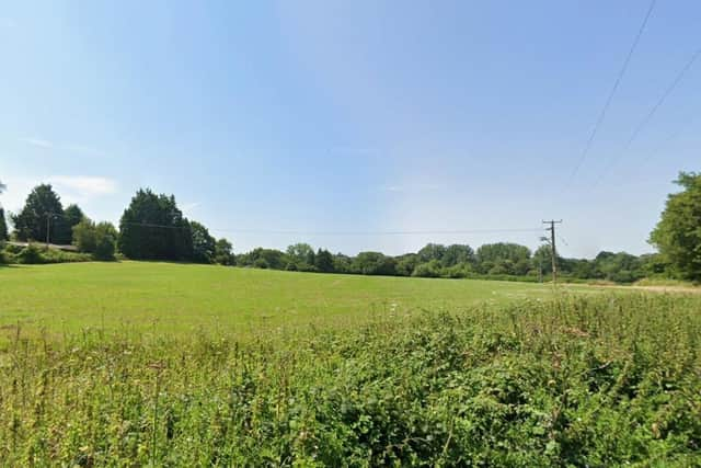

It said the EIA screening boundary is about 17.43 hectares and said the site is mostly greenfield land.
People can view the documents for this future application at planning.wealden.gov.uk using reference WD/2026/6502/SO.
The report said the proposed development would contain houses ‘no taller than 2.5 storeys/11.5m from first floor level (FFL) to ridge’, with houses up to two storeys fronting along Bird in Eye Hill to ‘graduate heights upwards towards the centre of the site’.
It said the plan would provide a mix of one, two, three and four-bed houses and said a 50m buffer has been integrated into the proposed development design to reduce noise from the Foxdown Construction industrial estate, which is adjacent to the site. It said the operational primary road access would be taken from Bird in Eye Hill (B2102) with a series of internal roads leading from the main access road.
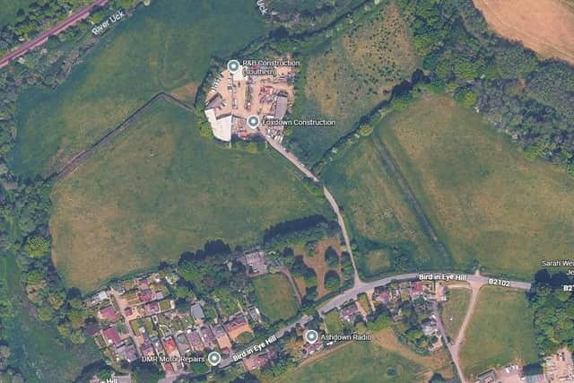
The report also said the existing simple priority junction that serves the site would be ‘upgraded’ to a ghost-island junction with improved visibility.
It said: “The industrial estate in the centre of the site will continue to be served by the existing access once the proposed development is operational. The access point into the industrial estate will be upgraded as part of the works.”
The report added that parking would be provided for each home ‘in line with the East Sussex County Council parking standards’ and said a new footway would be provided along Bird in Eye Hill. It said this would offer pedestrian access between the site and Uckfield town centre. A pedestrian and cycle access point is also proposed further west of the primary vehicular access, which would connect to an existing access track between existing homes. This would also connect the site to Framfield Road.
The report said new eastbound and westbound bus stops would be provided along Bird in Eye Hill, immediately to the west of the site.
It went on to say that the proposed development would have public realm, biodiversity and green space elements. These include: a 15m buffer to ancient woodland on the north east boundary; the retention and enhancement of existing internal tree groups through improved management; the retention and enhancement of the ‘vast majority’ of internal and perimeter site boundaries, including hedgerows and trees, with some additional planting; ‘considerable new planting’ across the site; green space that includes rough grassland and wildflower planting; and play spaces, including a Local Equipped Area for Play (LEAP) and Local Area for Play (LAP).
It said: “The proposed development will also provide a Suitable Alternative Natural Greenspace (SANG) to alleviate recreational pressure on the Ashdown Forest Special Protection Area (SPA) and Special Area of Conservation (SAC), which will include a 2.4km circular walking route within the site.”
The report said most of the site is within areas of ‘very low or low flood risk’ but added that there are ‘some areas of medium and high risk’. But the report said that introducing a comprehensive drainage strategy would reduce this risk.
It also said the site has a ‘moderate’ risk of Unexploded Ordnance (UXO) but said preliminary assessment by UXO specialists ‘considers that a detailed UXO risk assessment is not essential’.
The report continued said: “The Proposed Development will be delivered in a single phase. Site preparation/enabling and construction is anticipated to commence in 2028, with construction set to take place over five years and the proposed development being anticipated to be completed in 2033.”
It said a small stable in the southern area of the site would be demolished as part of the works.
In its ‘cumulative projects identified for appraisal’ section, the report mentioned that an outline application for up to 190 dwellings adjacent to the southern site boundary (WD/2024/1799/MAO) had been allowed at appeal. It also said a reserved matters application for 750 dwellings had been approved for land west of Uckfield, which is 1km west of the site (WD/2023/2939/MRM).