
'Several drivers ignoring the closure' - Motorists 'driving wrong way' along dual carriageway as West Sussex A-road remains shut

A full road closure has been requested in Bersted, as ‘water levels have remained static’ – with reports of drivers ignoring diversion signs.
The A29 Shripney Road was closed due to high levels of floodwater making the road unsafe on Monday (February 2).
The road remains shut on Wednesday morning.
The latest update from West Sussex Highways read: “We have continued to monitor Shripney Road, and water levels have remained static.
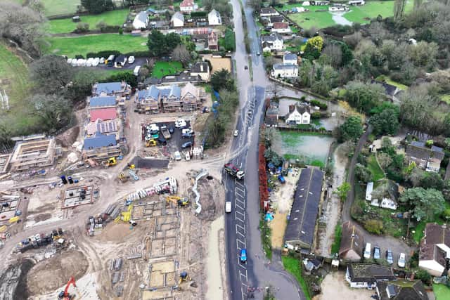

"However, we have experienced several drivers ignoring the road closure and driving the wrong way along the dual carriageway. As a result, we have requested a full road closure at the Salt Box Roundabout.
"Resident access will only be available from the north of the A29 via Woodgate. There will be several manned gateways along the route to ensure driver compliance with the road closure and to support residents in accessing their properties.”
A resident’s post on social media site, Nextdoor, quipped that Shripney and surrounding areas ‘are being twinned with Venice’ – such is the extent of the flooding.
Highleigh Road and Keynor Lane in Sidlesham also remain shut.
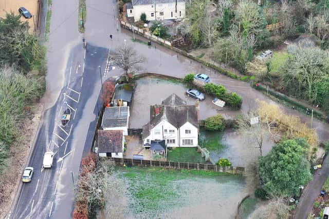
"Due to Keynor Rife flooding and high groundwater levels, Highleigh Road and Keynor Lane will remain closed for safety,” a West Sussex Highways statement read.
“We will be assessing the situation daily and will update you when we have further information.”
AA Traffic News reported that Highleigh Road is closed both ways from Rotten Row to Keynor Lane, whilst Keynor Lane is blocked both ways from Green Lane to B2145 Selsey Road.
Multiple flood warnings and alerts are in place for rivers across West Sussex, in the Arun district.
"The Aldingbourne Rife is high following weeks of rain,” the Environment Agency’s alert read.
"The Aldingbourne Rife is expected to rise a little. Minor flooding will affect fields, land at Riverside Caravan Centre, and could affect the car park at Tescos on Shripney Road and small parts of land off Durban Road.
"Minor impacts may also affect Arun Business Park, Shripney Trade Park, Whitfield Close, Maryland Crescent, Rife Way, Links Avenue and Kingsmead.
"In Barnham, only minimal flood impacts are expected on Barnham Road and Lake Lane.
"Only isolated showers are predicted Wednesday. River levels should begin to fall Wednesday afternoon, but will not fall far. More rain is forecast Thursday.
"Minor flooding will continue, and may approach properties Thursday. River levels could remain high for a fortnight. We are clearing debris screens in Barnham, our pumps at Felpham are running.
"Consider activating flood protection products. This message will be updated by 20:00 04/02/2026.”