
This is why the A29 remains closed in West Sussex; councillor fears climate change is 'increasing the likelihood of intense rainfall'

Shripney Road in Bersted remains closed due to exceptionally high water levels, with West Sussex Highways advising that conditions mean the road cannot yet be safely reopened.
The closure is in place at Saltbox Roundabout, with resident access only permitted from the A29 via Woodgate. Drivers have been urged not to drive through the closure unless they are accessing their property.
Not all motorists have heeded that advice, with reports of people 'driving wrong way' along the dual carriageway.
In an update issued on Thursday, February 5, West Sussex Highways said it was unable to pump water from the carriageway because surrounding watercourses are already full.
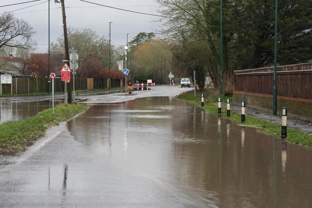

"Exceptionally high water levels mean that the road remains closed,” the authority said.
"We are unable to pump water from the carriageway. The rife carries water away from Shripney and is already full, meaning that any water removed from the carriageway will quickly be replaced by water from adjacent land and the surrounding rife.”
The authority said the site is inspected twice daily and staffed to support resident access. It also confirmed it had received reports that barriers had been moved, with a traffic management team sent to inspect and reinstate them if necessary.
West Sussex Highways added: “Shripney Road is closed at Saltbox roundabout. Resident access only is available from the A29 via Woodgate.
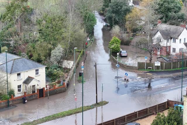
“Please do not drive through the closure unless accessing your property.
“We have received reports that the barriers have been moved. The traffic management team are on the way to inspect and reinstate if this is the case.
“The site is inspected twice daily, and the closure is staffed to support resident access. We will update our social media channels following each inspection.”
Flooding has also been reported on Lower Bognor Road and the road is currently closed.
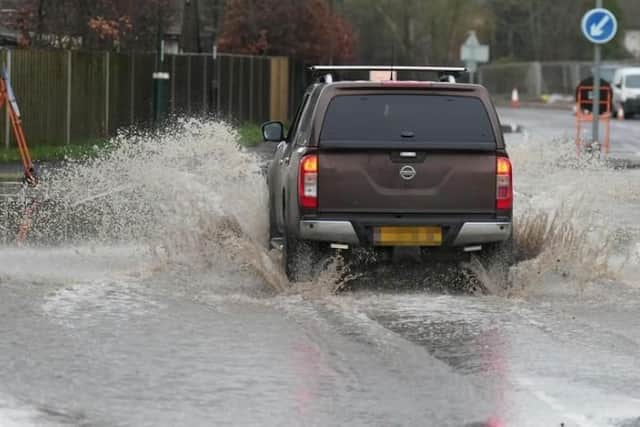
West Sussex Highways reported at 4.40pm on Thursday: “The closure is in place between Chalcraft Lane and Pagham Road. The site will be inspected again tomorrow morning, and a further update will be provided.”
The county council department has also postponed planned halogen bulb replacement works on the A29 Felpham Way, which had been due to start on Monday, February 9.
The authority said the works were delayed due to current network pressures in the area and would be rescheduled, with warning signs removed as soon as possible.
Residents are advised to follow official updates and avoid the closed section of Shripney Road while water levels remain high.
The ongoing flooding reflects long-standing issues in the area, according to county and district councillor Keir Greenway, a lifetime resident of Bersted. Following widespread flooding in October and November 2023, a formal Section 19 flood investigation examined why Shripney is particularly vulnerable.
“Shripney sits in a low-lying catchment, with water naturally draining through the Shripney Manor Ditch into the slow-flowing Aldingbourne Rife,” Cllr Greenway said. “The village also relies heavily on roadside drainage (ditches, pipes and gullies) to move water away during heavy rain."
He said the 2023 flooding was caused by several overlapping factors rather than a single failure.
“Exceptional rainfall from multiple storms fell on already saturated ground, groundwater levels were already high, and the Shripney Manor Ditch exceeded its capacity and came out of bank,” he said.
“When the ditch is full, highway drains can’t discharge properly, so water backs up and surcharges onto the road. At the same time, the foul sewer system was overwhelmed and discharging from manholes, and some highway gullies were partially blocked by silt and tree root intrusion.”
Cllr Greenway warned that climate change is increasing the likelihood of similar events in the future.
He added: “Climate change is increasing the likelihood of intense rainfall on saturated catchments, which puts villages like Shripney at ongoing risk.
The Arun district councillor for Bersted said the flooding in 2023 affected areas both inside and outside mapped flood zones.
“That shows the risk is broader than official flood maps suggest,” he said, noting that flooding in Shripney can come from several sources at once, including surface water, overflowing ditches, blocked drainage, high groundwater and sewer surcharge.
“When all of these overlap, flooding becomes more severe and much harder to prevent.”
The report concluded that while flooding cannot be entirely prevented, a number of ‘practical, achievable actions’ could reduce the impact of future events if implemented together. Further investigation has been recommended to better understand longer-term influences on flooding and to reduce future risk.