
Red heat warning in force as Sussex braces for record-breaking temperatures and major travel disruption: All you need to know

Sussex is facing one of the most intense heatwaves ever recorded, with temperatures forecast to approach 40°C and widespread disruption expected on roads and railways.
As of 9am on Wednesday (June 24), the entirety of the South East is now covered by the rare UK Health Security Agency (UKHSA) warning for extreme heat. Health officials warn that the hot weather could pose a risk to ‘everyone’s health, not just vulnerable groups’.
This follows a similar upgrade by the Met Office. Parts of Sussex – and the entirety of Surrey – have been placed under the government agency’s highest-level weather warning, until 9pm on Thursday.
It covers parts of northern and eastern Sussex, including: Crawley; Horsham; Billingshurst; Petworth; Haywards Heath; Uckfield and Crowborough.
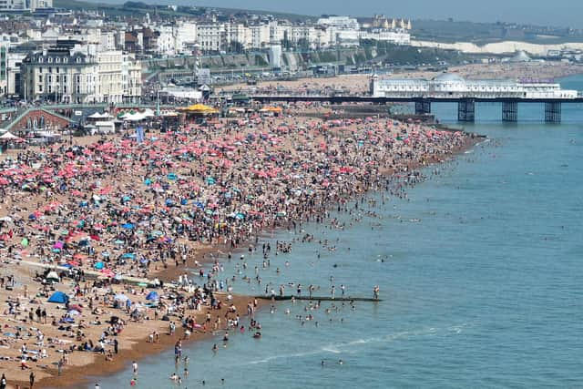

Forecasters say temperatures are expected to peak on Wednesday and Thursday, with highs of at least 39°C possible across southern England. If forecasts are realised, the UK's June temperature record of 35.6°C, set in Southampton in 1976 and Camden Square in 1957, is likely to be broken.
According to the latest BBC Weather forecast for Sussex, Wednesday will be exceptionally hot and humid, with temperatures rising above those experienced on Tuesday. Winds will remain light, offering little relief from the heat.
Conditions are expected to remain uncomfortable overnight, with temperatures staying above 20°C in many places. These so-called tropical nights make it difficult for people and buildings to cool down and can significantly increase the risk of heat-related illness.
Thursday is forecast to bring extensive sunshine and virtually cloudless skies, alongside another day of exceptional heat and humidity. An easterly breeze may develop during the afternoon, particularly along the coast.
The heatwave is also expected to be unusually humid. Dew points are forecast to reach around 22°C in some areas, making conditions feel particularly oppressive and increasing the risk of heat stress.
Met Office deputy chief forecaster Mark Sidaway said: "Red warnings are reserved for the most severe events and we're expecting severe and significant impacts from this heatwave, with health impacts likely for many, even beyond those who are normally more vulnerable to the heat."
The UK Health Security Agency has also issued Heat Health Alerts, warning that the conditions could pose a risk to life even among otherwise healthy people.
Dr Agostinho Sousa, head of extreme events and health protection at UKHSA, urged people to stay hydrated, avoid direct sunlight during the hottest part of the day and check on vulnerable friends, relatives and neighbours.
Rail passengers urged not to travel
The extreme temperatures are already affecting the transport network.
Passengers using Southern, Thameslink, Great Northern and Gatwick Express services are being urged to travel only if absolutely necessary on Wednesday and Thursday.
Rail operators have introduced emergency timetables, with trains running more slowly to reduce the risk of rails buckling in the heat. As a result, significantly fewer services will operate across the network.
Gatwick Express services will be suspended from early afternoon on both days, although Gatwick Airport will continue to be served by Southern and Thameslink trains.
Jenny Saunders, customer service director for the train operators, said: "I'd really urge our customers to think about what's best for them and to travel only if absolutely necessary on Wednesday and Thursday."
Passengers who no longer wish to travel can claim full refunds for tickets dated June 23, 24 and 25.
Thunderstorm risk later this week
While sunshine is expected to dominate for the remainder of the week, forecasters are also monitoring the risk of thunderstorms.
There is a chance of scattered thunderstorms on Friday morning and again on Saturday afternoon and evening, with a smaller risk of isolated thundery showers on Sunday.
Temperatures are expected to remain very hot on Friday and Saturday before gradually easing by Sunday. Even then, conditions are likely to remain warmer than average for the time of year.
Safety advice
Officials are advising people to:
• Drink plenty of water and avoid excessive alcohol consumption.
• Stay out of direct sunlight during the hottest part of the day.
• Wear sunscreen, light clothing and a hat when outdoors.
• Check on elderly relatives, neighbours and vulnerable people.
• Never leave children or animals in parked vehicles.
• Take extra care around water, as rivers and seas remain much colder than air temperatures.
The RNLI is also reminding beachgoers that cold-water shock remains a risk despite the hot weather and is encouraging swimmers to choose lifeguarded beaches where possible.
With record-breaking temperatures, tropical nights and major transport disruption expected, forecasters say the next 48 hours could be among the most significant heat events the UK has experienced since the record-breaking summer of 2022.