Sussex weather: Met Office predicts more rain amid flood alerts
and live on Freeview channel 276
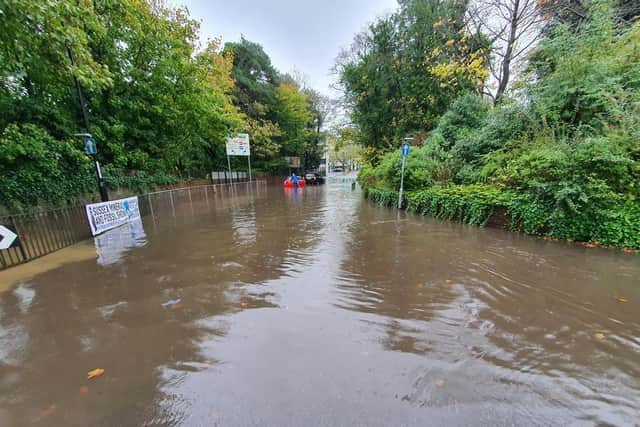
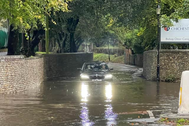
The Environment Agency warned this morning that ‘local inland flooding is probable’ in parts of South East England on Sunday. Residents were told that land, roads and some properties could flood and ‘there could be travel disruption’.
Those fears have been realised in Sussex, with multiple flooding incidents reported.
Advertisement
Hide AdAdvertisement
Hide AdA Met Office spokesperson said: “The band of rain across southeast England is slowly clearing away, but this will be swiftly followed by a band of heavy showers. Take care if you're travelling on the roads this afternoon.”

Where have flood alerts been issued?
The Environment Agency still has 14 flood alerts in place.
Flooding is possible in; Chertsey Bourne; Cuckmere River; Eastern Yar; Lower River Medway; River Adur East Branch; River Mole and its tributaries from Kinnersley Manor to South Hersham; River Rother and its tributaries from Turks Bridge to the Royal Military Canal; Rivers Eden and Eden Brook; River Uck; Scrase Bridge and West Common Streams; Upper Ouse; Upper River Derwent, Stonethwaite Beck and Derwent Water; Upper River Medway; Upper River Wey.
Forecast for the rest of the day – and the week ahead?
According to the Met Office, rain will become heavier and more persistent across southeastern parts of England this morning but will clear this afternoon.
It is expected that ‘bands of blustery showers’ – some heavy and perhaps thundery – will move eastwards. Temperatures will peak at 15 degrees Celsius.
Advertisement
Hide AdAdvertisement
Hide AdThe Met Office said it will become drier inland during the evening and overnight but further blustery heavy showers ‘should still mainly affect southern coastal districts’. This could result in longer spells of rain. Temperatures will drop to eight degrees Celsius.
Looking ahead to Monday, it will be ‘rather cloudy with further heavy showers’. These will ‘probably become more widespread for a time in the morning before easing later’, the Met Office predicted.
It will become ‘increasingly windy’ into the evening.
The weather from Tuesday to Thursday will be ‘unsettled and often windy through this period’.
A Met Office spokesperson added: “Further rain and showers expected, although Thursday perhaps drier. Generally mild or very mild, but tempered by the wind.”