World Water Day: Pilot project highlighted as Brighton named in top 10 of flood risk areas


To mark World Water Day today (Tuesday, March 22), Brighton and Hove City Council has highlighting the work being done to reduce the risk of flooding to properties in a vulnerable part of the city.
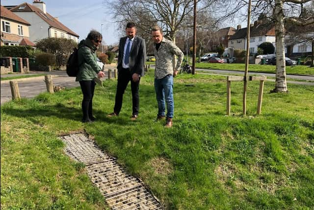
Work has been taking place on Carden Avenue as part of a pilot project called Shaping Climate change Adaptive PlacEs (SCAPE) which is partly funded by the European Union’s Interreg 2 Seas programme.
Advertisement
Hide AdAdvertisement
Hide AdA council spokesman said the project involves directing surface water which runs down the road into basins where pollutants are collected and cleaner water can then then be absorbed into city’s natural aquifer below.
MORE COUNCIL NEWS: Plans for a major revamp of a Brighton park |
The spokesman added: "The idea is to mimic natural systems in which gravity and landform are used to remove as much excess rainwater flow as early as possible. This can help reduce the risk of flooding during heavy downpours when drainage systems can get overwhelmed."
Phase one of the project at Darcy Drive has already been completed with phase two between Carden Hill and County Oak Avenue scheduled to be finished later this spring.
Advertisement
Hide AdAdvertisement
Hide AdWatch the video attached to this story to find out more about the project and the work already completed at Darcy Drive or watch it on YouTube here: SCAPE Shaping Climate Change Adaptive Places - YouTube
The council spokesman said the reason for action was due to Brighton & Hove being ranked 8th of the top 10 Flood Risk Areas in England with surface water run-off from heavy rainfall posing the biggest problems. Over 30,000 properties in the city are at risk of flooding, the council said.
Councillor Jamie Lloyd, member of the Environment, Transport and Sustainability committee, said: “I’ve been down to see the work on Carden Avenue and I’ve been very impressed.
“The project is using extremely clever techniques to lower the risk of flooding to properties, but using the natural landscape to make sure it still looks pleasant to people living nearby.
Advertisement
Hide AdAdvertisement
Hide Ad“We know that flooding is an existing problem in the city and one that is sadly only going to get worse with climate change. By using techniques like this, we can help to reduce the risks to our homes and businesses in a way that also enhances the look of the city. I’m looking forward to seeing what we can learn from this project and how we apply those lessons.”
Have you read: The Ivy set to open a second restaurant in Brighton