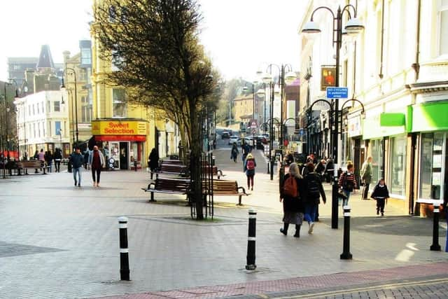
Remembering when a busy area of Hastings town centre was once marshy farmland
and live on Freeview channel 276
He writes: There were many events at His Place Church in Hastings town centre on Saturday 12 March as part of a big fund-raising initiative to restore the building.
One of the Victorian church’s two entrances is on Cambridge Road, which In the early 19th century was nothing like it is today.
Advertisement
Hide AdAdvertisement
Hide AdA drawing dated May 1830 shows the road was a winding track, with a big farm and marshland on the north side.
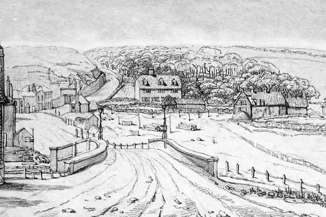

In the foreground of the drawing is a bridge over the Priory Stream, which drained the Priory Valley.
Today the stream can still be seen in Alexandra Park, but from there it runs underground down to the town centre where it joins the main drainage system.
The bridge, which stood where the seven streets now come together, was the only way out of town to the west.
Advertisement
Hide AdAdvertisement
Hide AdBeyond the bridge on the left is the America Ground, where a thousand people lived and worked in the 1820s, most of them originally being squatters on what appeared to be ownerless land.
But in 1828 the Crown decided that it was the owner, and all the occupants were given seven years notice to quit.
Until about 1830 most of these people had been labourers, craftsmen and suppliers helping the large-scale development of Hastings then taking place, especially in Wellington Square and Pelham Crescent.
But in 1828 James Burton started creating the new town of St Leonards, so by 1830 many of the Ground’s people had started going to work there, and in the following years many took their houses and workshops with them before the Crown’s 1835 deadline.
Advertisement
Hide AdAdvertisement
Hide AdOn the right-hand side of the road in the 1830 drawing is Priory Farm, with the farmhouse in the middle of the picture and its barns and yards on the right. The farm was on the site of the Augustinian Priory, set up there in the 1190s.
The road in the drawing is on top of an embankment built in 1580, against which shingle had accumulated over the next two centuries to form the America Ground.
The road in the picture is going via Dorset Place (where the bend is), but it was all in poor condition and very steep, so in 1836-38 it was completely rebuilt as a turnpike road.
It was raised and straightened, and a new section cut through the hill to form Cambridge Road as we know it today.
Advertisement
Hide AdAdvertisement
Hide AdBut this meant there was a spare piece of land – the old road - between the north edge of the America Ground and the new straightened Cambridge Road.
It was on this empty ground that the Congregational Church was built in 1857, with the United Reformed (His Place) Church replacing it in 1884-85, cutting into the side of Cambridge Road.
Have you read? Hastings Beatles Day is back with over 70 live acts