New Sussex amber weather warning with thunderstorms expected on Monday, August 15
This article contains affiliate links. We may earn a small commission on items purchased through this article, but that does not affect our editorial judgement.
and live on Freeview channel 276
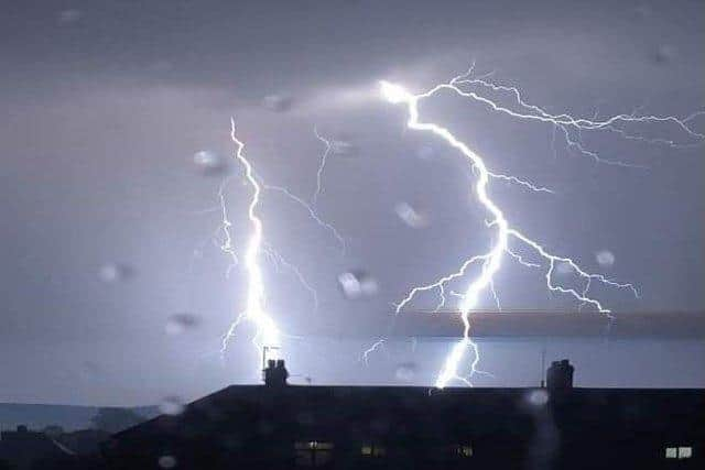
Following days of extremely hot weather, ‘hit-and-miss thunderstorms’ are now likely to develop through Monday (August 15), according to the Met Office.
This will produce ‘torrential downpours’ for some spots and ‘possible disruption’.
Advertisement
Hide AdAdvertisement
Hide AdThe Met Office warning is is place until Wednesday (August 17).

What to expect
We have been told to expect spray and sudden flooding, which ‘could lead to difficult driving conditions and some road closures’.
A Met Office spokesperson added: “There is a small chance that homes and businesses could be flooded quickly, with damage to some buildings from floodwater, lightning strikes, hail or strong winds.
“Where flooding or lightning strikes occur, there is a chance of delays and some cancellations to train and bus services.
Advertisement
Hide AdAdvertisement
Hide Ad“There is a slight chance that power cuts could occur and other services to some homes and businesses could be lost.”
There remains a low chance of rain across Sussex today (Monday) but the likelihood of downpours increase tomorrow and Wednesday.
‘Hail and frequent lightning also possible’
The Met Office’s deputy chief meteorologist, Jason Kelly, said: “The current hot weather will make way for a thundery breakdown from the west, which will spread south and east in the early part of next week. Ahead of this, isolated but intense thunderstorms are possible Sunday, Monday and Tuesday.
“The warnings highlight the chance of some places seeing around 50mm of rain falling in a three-hour period in the north, with some areas further south possibly seeing around 30mm of rain in a three-hour period.